Boats & Ships
Description
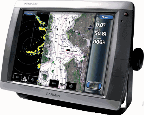
Garmin GPSMAP 5012 is a multifunction Touch Screen display that can act as a stand alone plotter or can add fishfinder and radar options. BLUECHART g2 Vision brings a new world of 3 dimensional perspective above or below the water, high resolution satellite images and auto guidance.
Features:
High speed processor for ultra fast screen redraw.
BlueChart g2 Vision compatable.
Screen display: Sunlight readable, 256-colour 12& quot; diagonal 246mm x 185mm, colour VGA 1024 x 768 pixels.
Tracks: 10,000 point automatic track log; 20 saved tracks (700 points each) lets you retrace your path in both directions.
1500 waypoints with name and graphic symbol & proximity support.
20 reversible routes of up to 300 waypoints
NMEA 2000 Interface
Built-In tables for sun & moon calculations.
Alarms: Anchor drag, arrival, off-course, proximity, clock, shallow and deep water, battery.
12 channel WAAS capable GPS receiver.
Waterproof case to IPX7 standard.
Video Input/output.
Read More
PT. Jatt Marina
GPS, Marine Radio, Downrigger, Radar, Plotter
Address: Jl Brigjen Katamso 16A,
Semarang, Central Java
Indonesia, 50125
Tel: 024 8312547
Fax: 024 8312547


